This early D12 map has been requested for a remake
  • 212 posts
  • Page 3 of 15
momagajic wrote:
I like it ,great job ! I just want ask if someone think about it to hawe one more connection between Cornwal and Munster ..and i must say that i more like vexer idea for colors ..i daont say aero make it wrong or bad ,but i more like darker option ,you decide guys Im just a poor player ^^
aeronautic wrote:
GB5 (click to show)
Vexer GB (click to show)

I much prefer Vexer's colours, I will have a play around with the file he sent back to me and see if I can compromise on the order of the colours to suit all tastes.

Please pay particular attention to the land texture and how much the new colours have enhanced it.

Thank you all for plenty of feedback, this is exactly what maps need.
Hyd yn oed er fy mod Cymraeg , dim ond yn siarad Saesneg, felly yr wyf yn gobeithio y bydd y cyfieithu yn gywir.
The_Bishop wrote:
Well, if Aeronautic likes Vexer's colours, then I think we can go on with them. It's true that textures stand out much better in Vexer's version.

As for territory names my suggestions are:

When you merge 2 or more counties put the name of the most important. For example if you merge Avon and Wiltshire the name should stay Avon, because it is (was) the county of Bristol town. I don't care what the Wiltshire villagers think, they will be unhappy for that but they are a minority.
Possibly I would avoid to use double names.

When the county name equals to the mean town just adding "-shire" at the end, then please remove it. For example Lincoln and Lincolnshire, or Glouchester and Glouchestershire. The names became so long and unreadable for a non-British like me! It is not that I want abbreviate them, just to name them after the town rather than the county.

What about introducing some very famous British cities? London, Manchester, Birmingham... I think would be cooler, is what people expect to see and much readable just because they are very well known names.

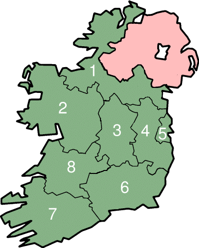
By the way I know it is not easy, specially if you want to respect the geography and at the same time save the gameplay as it is in Noxon's version, which contains some geographical cheats and imprecision. If you want I can try to figure out a suggestion by myself to show a different possible arrangement.

I agree to merge Powys and Gwent for removing the mountains.
«God doesn't play dice with the World» ~ Albert Einstein
aeronautic wrote:
Vexer created a better colour scheme, which Fendi also used and enhanced, making a version not yet seen by the forum. I kept all Vexer's effects and layers and adjusted them to Fendi's colours.

The_Bishop suggested some changes to names and borders, some of which were suitable to the old game-play, which we have to keep.

This version incorporates all the suggested changes that were usable and all the colours worked on by all the Head Cartographers (past & present) jointly.

Just so that there is no cause for the same suggestions, this map is too large a scale for cities. A few were used where their names were too long as counties, but were ones also referred to as the county reference in the postal service. Also most of the territories have two or more major cities and would cause upset to people whose cities were overlooked for another. One or two borders had to be moved in order to keep the same game-play.
GB6 (click to show)
Swapping Photoshop versions back and fore screwed up the territory labels, so I had to choose a different font.
I also utilised Bishop's suggestion of the flags.
For nostalgia - England & Wales 1818 (click to show)
Hyd yn oed er fy mod Cymraeg , dim ond yn siarad Saesneg, felly yr wyf yn gobeithio y bydd y cyfieithu yn gywir.
naathim wrote:
I think that that is a very nice compromise between the intensity of the colors.

Like the new font.

Love that you put the Hebrides in there!

Still much prefer your 'rainbow' order to the way these colors are laid out.

The shading around the borders seems to vary from region to region?

At this point I think the flag in the background detracts more than it adds?

I'd make the labels for the channel and atlantic ocean more horizontal. You can still keep them curved, just swing them both down about 30-45 degrees.

This is a really, really beautiful map. It could go out like this and I think it would be among the best looking on here!
4960epic wrote:
I like the names being changed to be more accurate, but something that made the old map pop to me was the little bit of texture that was in some of the areas like ireland and scotland.
PsymonStark wrote:
It looks very good. Only complain is why Outer Hebrides. It makes you think where are the Inner Hebrides. I'd choose Hebrides/The Hebrides as its name because there is no possibility of mistake as the territory is located there and connected with a line to the Highlands.

Another small thing to consider is the adequacy of North Leinster and North Munster, which look a bit artificial. What about renaming them Dublin (Midlands already taken) and Shannon, respectively?
Living proof that everyone can be a brilliant great good decent cartographer.
Matty wrote:
Lol, took me a while to see what you did with the hebrides.
I really like the no mountain solution in whales as well, and the overall colour scheme looks pretty good. Let's keep the rainbow idea for another map.

However, I really, really don't like the colour of Northern Ireland. Not sure if Southern Ireland is bad as well, it looks bad now, but it might be because of N Ireland.

Also, Scotland and S. Ireland can be a tad bit less bright, or everything else a tad bit brighter.
"Strength doesn't lie in numbers, strength doesn't lie in wealth. Strength lies in nights of peaceful slumbers." ~Maria
Cireon wrote:
I would prefer a slightly thinner font. The current font looks very fat.

I would opt for turning up the brightness of less saturated areas as opposed to making everything more desaturated, to fit better with the previous version of the map.

Like the way you solved the mountain problem around Gloucester. The territory changes in Scotland are also interesting.

I personally don't mind the colour scheme as it is.
“This is how humans are: We question all our beliefs, except for the ones that we really believe in, and those we never think to question.”
- Speaker for the Dead, O.S. Card
PsymonStark wrote:
Now that I can see the map properly, I think it's even better. The new font looks very nice.

About the flag in the background, I am unsure about it, because this is not a map from the UK, but also Ireland which wouldn't be represented. Personally I don't care a lot about it, but we could find someone that does.

Still unconvinced about the Ireland colours, and preferring the old version from Vexer, but absolutely neat as it is now.
Living proof that everyone can be a brilliant great good decent cartographer.
The_Bishop wrote:
It's looking ultra good for me.

I know Aeronautic want a map based on counties and not on cities, since probably dosn't like the proposal to name that territory Dublin. My opinion is: if you have one territory named North Leinster the other one should be logically named South Leinster, isn't?

As for the colours, instead of 2 blues I would prefer 2 greens. For example give to West Country the colour of Ulster and make Ulster light green.
«God doesn't play dice with the World» ~ Albert Einstein
Virtuosity98 wrote:
This is very good. The only thing I would say is that Scotland is a little bright, and the sea names are a little too vertical for me.
It is now Day 8. Please submit your Lynch vote, as well as any Role-specific Day actions you wish to perform (countdown).
Day Actions:
• #LYNCH [player], #NO LYNCH, #ABSTAIN in forum thread.
• Role-specific actions (via PM with V98).


aeronautic wrote:
Just a bit of British info:

The Union Flag has never officially been decreed as our national flag and although widely used by civilians on land, it remains the flag of the Monarchy rather than the Union and is restricted to Military and Official Naval Craft and Air Craft only, where it is a slightly different size ratio 1:2 and called the Union Jack.
The land flags are set to a size ratio of 3:5 and are known as the Union Flag.
In 2007 there was a proposal made in the name of fair representation, to add Wales to the Union Flag. Wales was already a part of the Kingdom of England when the flag of Great Britain was created in 1606 and not deemed necessary to have it's own representation on the flag.

Personally, I am not locally patriotic enough to consider myself anything other than British. I do not speak the old language (Welsh Gaelic) and believe it to be a hindrance to modern trading and unity. I served the British Forces and that is where the true union is. Therefore, I think that adding the Welsh Dragon to the Union Flag is unnecessary. We are British people that all unified centuries ago and we should be proud to stand under one unified flag.
Hyd yn oed er fy mod Cymraeg , dim ond yn siarad Saesneg, felly yr wyf yn gobeithio y bydd y cyfieithu yn gywir.
PsymonStark wrote:
The current division in regional authorities of Ireland is this one (until 2014):
http://upload.wikimedia.org/wikipedia/commons/f/f7/IRL_Regions.png

I believe that's better to use the old province names, but we have just 4 of them for South Ireland (Connaught, Meath, Leinster, Munster). There are county-like alternatives, though. Here it is the current North Munster region:
http://en.wikipedia.org/wiki/Mid-West_Region,_Ireland . Quoting there:
Wiki
The region is also referred to as the Shannon Region as the lower River Shannon passes through the region forming a distinctive corridor and unifying force in the character of the area.
Thus I proposed Shannon to avoid having "Mid-West"-like labels.

And also, in that map region #5 is Dublin. We can't use Midlands as it is already in UK, so I think it's the best option.

If we want to have an extra accurate map, borders in Ireland should be redrawn following the map I just provided, with #3, #4 and #5 together. They follow the gameplay too.
Living proof that everyone can be a brilliant great good decent cartographer.